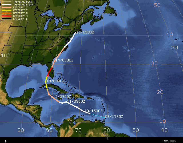
Hurricane Charley
On Friday August 13, 2004 Hurricane Charley made landfall on the west coast of Florida near Punta Gorda as a Category 4 hurricane. Sustained winds were estimated at 145 mph during landfall with gusts as high as 180 mph. The storm surge (rise in sea level) associated with the hurricane was between 13 and 15 feet.
As of Monday 16 August 17 people had been confirmed dead as a result of the hurricane. During the storm over 1 million people in Florida were without power, and as of Monday over 250,000 people still did not have power. Thousands of people in Florida are homeless as a result of this storm and insured property losses have been estimated at over $11 billion.
The links below provide some weather images of this event.
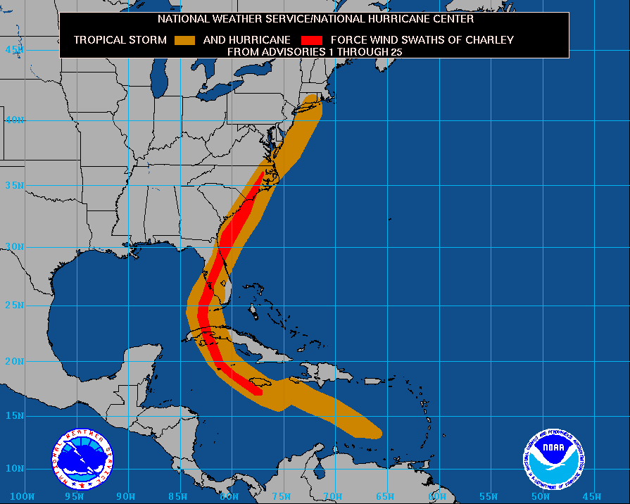
Map of Hurricane Charley's Winds
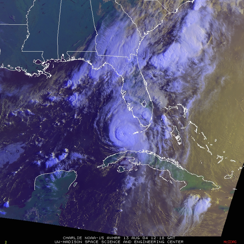
NOAA 15 Visible Satellite Image
Loop of Visible Satellite Images
Loop of Infrared Satellite Images
Doppler Radar Reflectivity from Key West
Doppler Radar Velocity from Key West
Doppler Radar Reflectivity from Tampa Bay
Doppler Radar Velocity from Tampa Bay
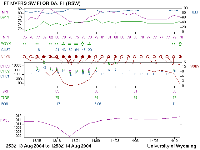
Meteogram from Fort Myers (Note the lack of precipitation as the center of the storm passes)
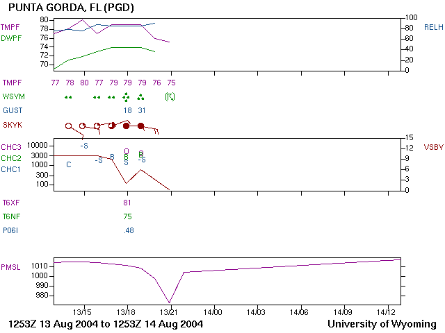
Meteogram from Punta Gorda (No precipitation was observed at this weather station as the eye passes overhead. Shortly after the eye passed this weather station went off the air)
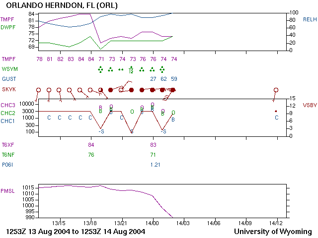
Meteogram from Orlando (This weather station also went off the air after the hurricane passed)
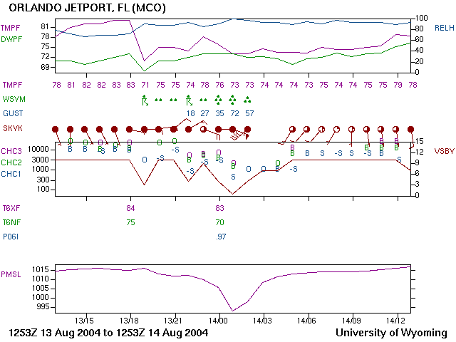
Meteogram from Orlando Jetport