Shallow upslope clouds in Colorado after a cold frontal passage
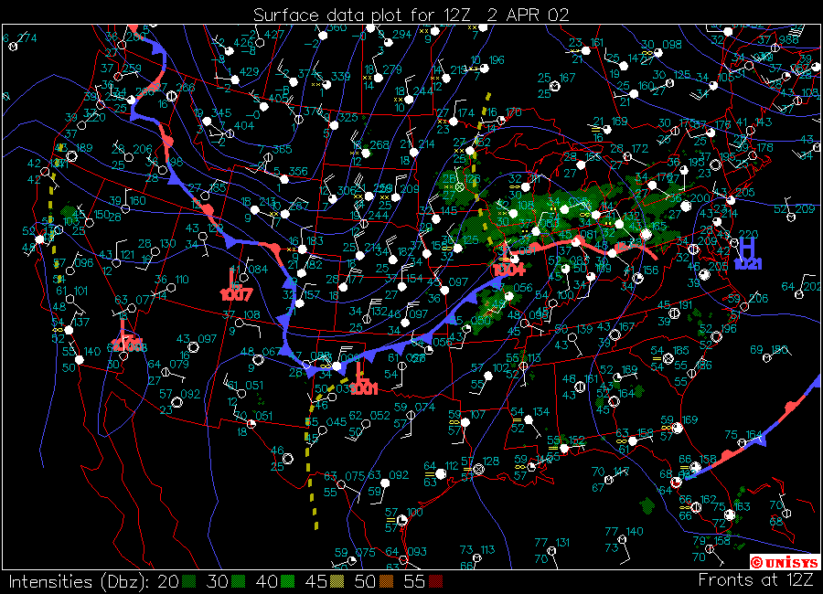
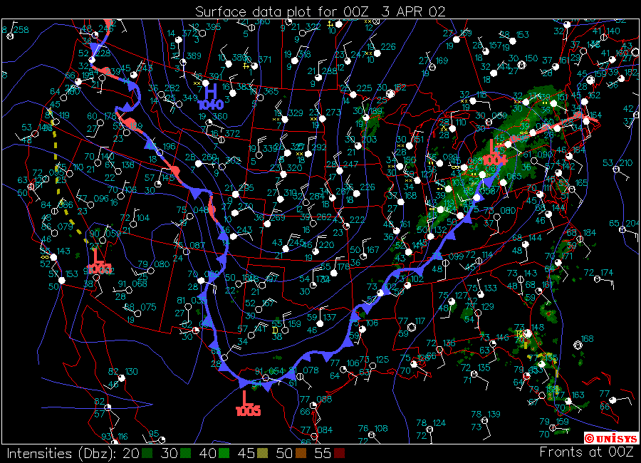
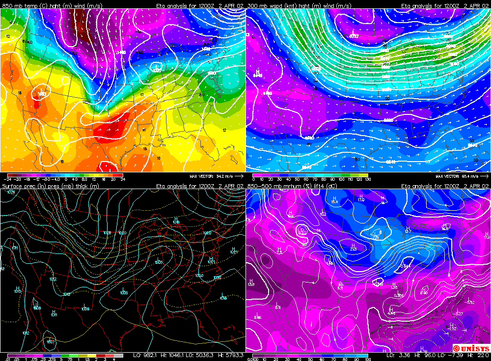
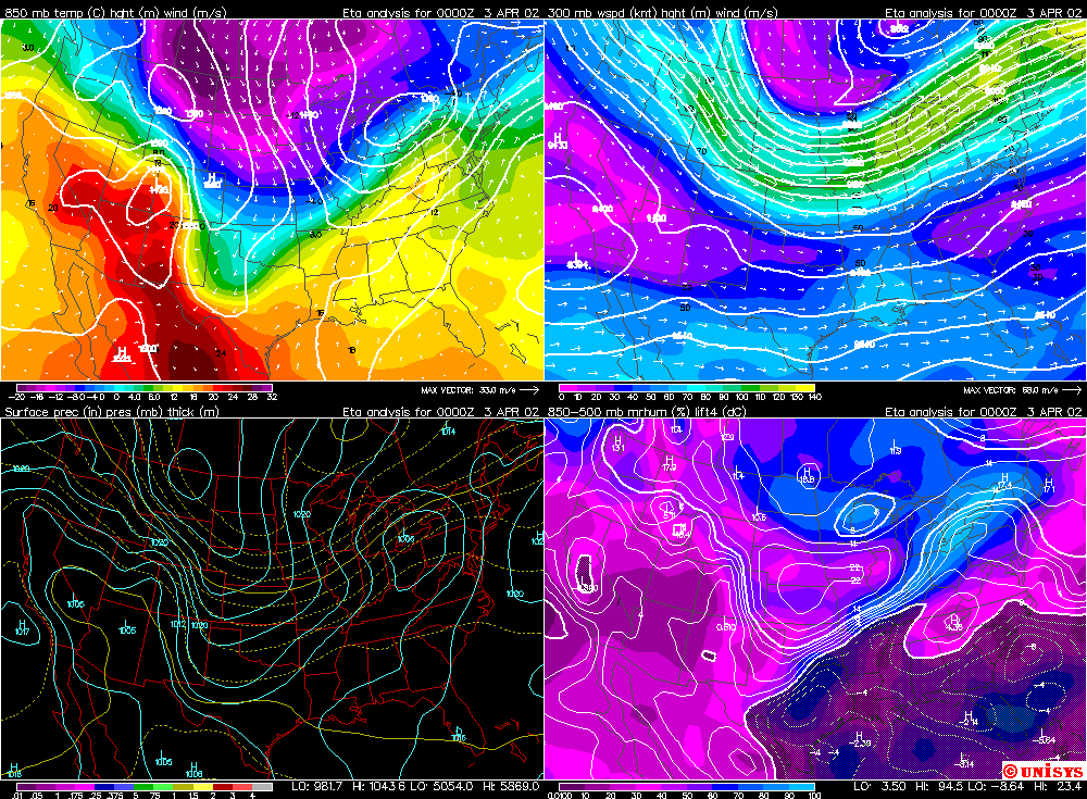
A region of high pressure was located north of Colorado on April 2, 2002. This resulted in northeast winds in eastern Colorado and upslope conditions. The links below show surface and upper air weather maps of this event. A visible satellite image loop shows the shallow upslope clouds that resulted from this flow.
Surface weather map for 12 UTC April 2, 2002
Surface weather map for 00 UTC April 3, 2002
Upper air weather maps for 12 UTC April 2, 2002
Upper air weather maps for 00 UTC April 3, 2002
Loop of visible satellite images from April 2, 2002
If you look at the visible satellite image loop carefully you can see high level clouds (cirrus) moving from southwest to northeast over the top of the low level upslope clouds (stratus). The movement of these high clouds indicates that the wind direction changes from northeasterly near the surface to southwesterly at upper levels of the troposphere.